
Recently, I had the good fortune of sampling some bikepacking through Tuscany, Italy, and it was a truly wonderful experience, so I want to share it with the world as it’s a bikepacking adventure thats accessible to pretty much anyone that knows how to ride a bike.
I feel that bikepacking routes shouldn’t be static; they are constantly changing and evolving with what’s occurring in real-time. The aim is to make this a living, breathing route that pivots in line with road closures, weather events, and business changes.
Hence, the plan is to encourage feedback and route suggestions. I have a plan for that, but for now, I just want you to look at this awesome map and watch this space grow. (For FAQ’s, scroll to the bottom of the page).
Inspiration for this route came from:
- The Tuscany Trail bikepacking event (seriously huge and awesome event) with an earlier iteration of the event following 90% of this route. Tuscany Trail Website
- The Via Francigena biking / hiking route that runs from Canterbury, UK to Rome, Italy.
Section 1 →62km ↑336m ↓320m ⇢35%
Pisa to Castelfranco Di Sotto
We found this to be a very relaxing day and a great way to kick off the tour with little climbing and nothing technical.
Although very busy with tourists, Pisa & Lucca absolutely blew me away, and I wasn’t quite prepared for how impressive the UNESCO World Heritage Listed Piazza Del Duomo in Pisa was actually going to be. These buildings date back all the way to the 11th century, which was a fantastic prelude for what was to come.
The roads out of Pisa were a little uninspiring, to be honest, but it was good to get used to riding on the right side of the road for a little bit.
Before too long, we hit some beautiful bike paths that weave through the Serchio River, which is the third longest in Tuscany. Beautiful bridges, houses, and farmlands dot the map, and you should cross some cyclists coming out from Lucca on a day trip.
Lucca is another very impressive medieval city with plenty of sights and sounds. We headed for the Piazza dell’ Anfiteatro, which is again heavily touristed but breathtaking in beauty. We found a bakery nearby for lunch, although you might choose to eat in the Piazza. There was a music festival on, so we couldn’t explore the surrounding city walls, although it looks as though you could lap the city and take advantage of the elevated views on it.
The roads out of Lucca brought us to the beautiful Lucca aqueduct, which doesn’t date back as far as we thought (19th century), before some more quiet asphalt roads that lead past a CONAD supermarket where you can fill up your bottles.
A little bit of non-technical single track and smooth gravel brings you past Lake Gherardesca and a lovely state forest before a small asphalt climb up Montefalconi and into the heart of Castelfranco Di Sotto.
“We couldn’t find accommodation in Castelfranco di Sotto, so we got an Airbnb over the railway tracks in San Romano. The accommodation was lovely, but there isn’t much to do in San Romano, so aim for Castelfranco Di Sotto if you can.”
Open RWGPS Map – Tuscany Trail (Part 1) Pisa, Lucca, Castelfranco di Sotto
Section 2 →67km ↑1,349m ↓837m ⇢36%
Castelfranco Di Sotto to San Gimignano
This day features quite a bit more climbing than the first with gravel becoming slightly more technical in parts whilst taking in some beautiful countryside.
A slight climb out of Castelfranco Di Sotto and through San Romano before a seriously steep climb, first on asphalt and then moving to gravel through a slightly technical, remote(ish) forested section.
From that point onwards, the gravel becomes much smoother and climbing more manageable. Just before Ghizanno (where we stopped at a cute bakery), there’s a strange building with artworks littered around it.
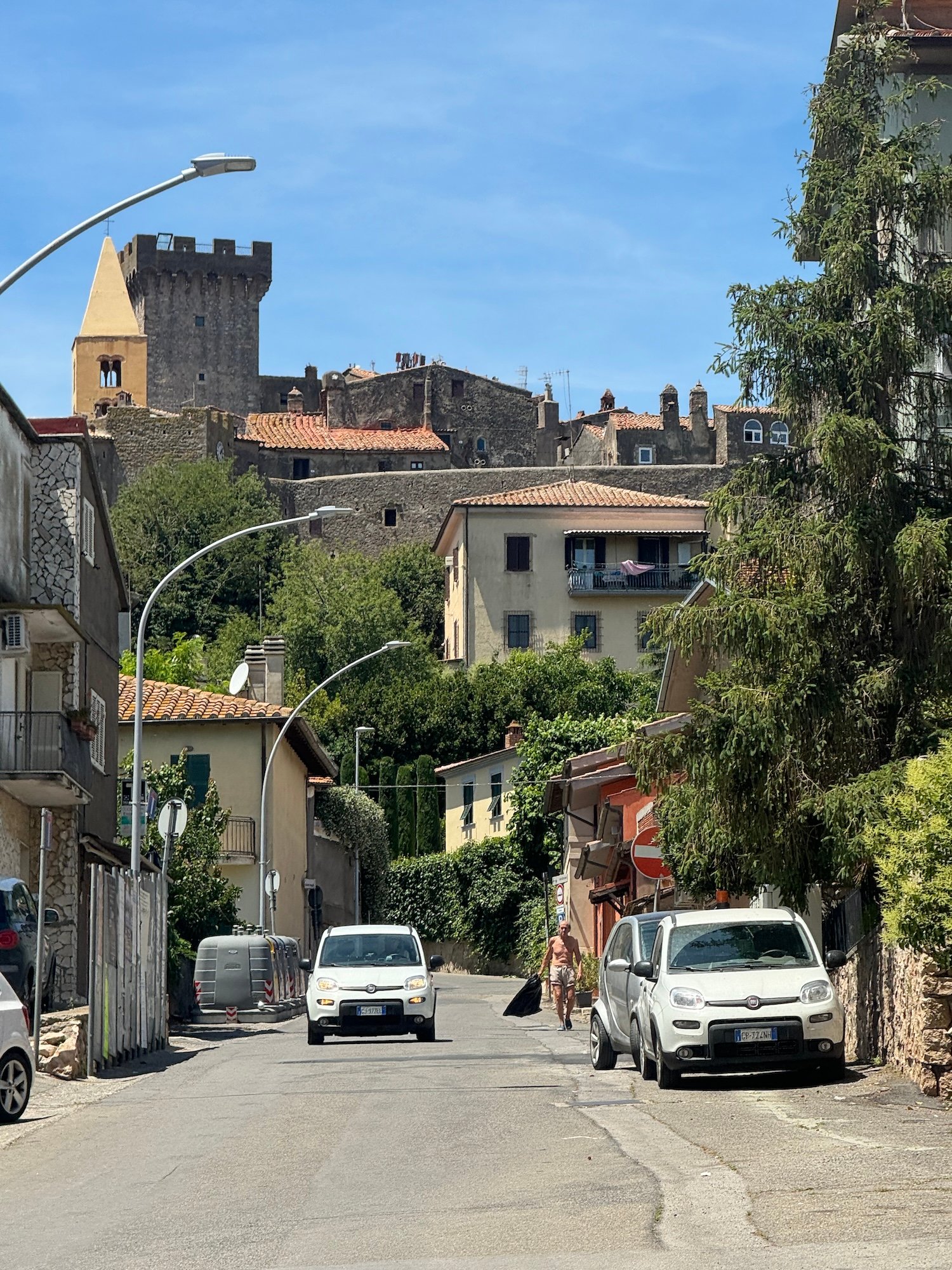
Lajatico, your next stop, is a gorgeous little village on a hill and birthplace of Andrea Bocelli with a theatre just over its crest where Andrea comes back to every year to perform. Make sure you stop in the town square of Lajatico; there’s another really cute cafe and many people coming and going.
From there, you’ll start to see a church from Volterra poking out in the distance. Some lovely roads and a descent climb will bring the church closer and closer until you reach the city.
“Volterra is another stunning walled medieval city along The Tuscany Trail. We didn’t stay long, forging on to San Gimignano instead; however, it would certainly be worth spending a night.”
Open RWGPS Map – Tuscany Trail (Part 2) Castelfranco Di Sotto, Ghizzano, Lajatico, Volterra
Section 3 →30km ↑619m ↓830m ⇢55%
Volterra to San Gimignano
Certainly not to be taken as a rest section as there’s plenty of climbing in the following 30kms.
You’ll get a pretty gnarly gravel climb of 9km at 5% with switchbacks to start followed by a slightly technical descent with some really steep sections. Some sections are steep enough that you might find walking preferable so as to enjoy the incredible scenery.
Before long, San Gimignano will come into view: a medieval, UNESCO World Heritage listed walled city, the most gorgeous we had seen on our journey so far.
“We stayed at Hotel Le Colinne; they had a space out the back for our bikes, and we had a really nice dinner at the attached restaurant. The real highlight of the day, though, was walking up to San Gimignano for a gelato via “Via Vecchia per Poggibonsi” (which is a quiet gravel road out the back, leading up to San Gimignano). We chose to walk at sunset and received a spectacular sunset in full view of San Gimignano. On the way down, once the sun had set, we were surrounded by fireflies (luccioli), with the backdrop of San Gimignano lights.”
Open RWGPS Map – Tuscany Trail (Part 3) Volterra, San Gimignano
Section 4 →49km ↑642m ↓628m ⇢54%
San Gimignano to Siena
Probably the most technical section of the tour. Quite a few areas where you are required to get off and walk for small sections unless you are on a mountain bike or technically gifted. To be fair, we did have some storms pass through the night before, so the road might not be as technical as the time that we rode it as the initial section had quite a few puddles.
The route does join up with parts of the Via Francigena Route (a 2000km hiking or pilgrimage route from The UK to Rome) which seems to follow some mountain bike trails that we found ourselves on for small sections of the day. Whilst it can slow momentum to get off and walk parts, it’s intermittent and the trails are gorgeous as well as much better than any road alternative.
Before long, your sites will be set on the tiny walled village of Monteriggioni (a tiny medieval village perched on the hill). Again, quite a few tourists, but what a gorgeous spot to stop for lunch!
Some more slightly technical sections before Siena comes into view, and you are greeted by Siena. A UNESCO World Heritage listed city and one of the most well-preserved and beautiful cities in all of Europe!
“We chose to stay just outside the city walls at a little place called “Hotel Il Giardino,” who let us put our bikes in their storeroom. We chose to have our rest day in Siena as it’s likely the place with the most to see and do along The Tuscany Trail as well as the presence of some excellent Tuscan cuisine. Our best meal came from “Il Bargello” just off the Piazza del Campo. The Pici all’Aglione in salsa di Pomodoro is the finest example of homemade Pici (a local pasta) and Tuscan cuisine that you will ever find! It’s like eating a warm hug from your Nonna.
The views up the Torre del Mangia are unbelievable if you don’t mind a stair climb, but get there early to beat the crowds.”
Open RWGPS Map – Tuscany Trail (Part 4), San Gimignano, Monteriggioni, Siena
Section 5 →66km ↑912m ↓827m ⇢59%
Siena to San Quirico d’Orcia
It’s hard to play favorites, but this was easily our favorite day on the bike for the whole tour. There is still plenty of climbing, but you could only describe the day as pure magic! This section enters into the UNESCO World Heritage listed “Val d’Orcia” region where scenes of Gladiator were filmed. It’s easy to see why as you pass through the region as it’s preserved as you would believe it to be a millennia ago.
Seriously smooth white gravel roads on this section and quite early on, there’s a market for section of the Strada Bianchi cycling grand tour race. While prominently gravel before lunch, it’s so smooth it’s like riding on the tarmac.
Mid-ride you’ll pop into the beautiful town of Buonconvento where the pace of life seems to be as relaxed as anywhere I have ever been. We didn’t have much of a look around, but there appears to be much more to the town than just the main strip.
Another Strada Bianchi section follows with some seriously cool switchbacks before climbing into the cute medieval, walled, hilltop village of San Quirico d’Orcia (another one of our favorite villages and not as many tourists than what we had seen so far).
“We stayed at Resort Casanova in San Quirico, which was our favorite stay for the entire trip that featured funny little swimming caps that they made us wear in the gorgeous pool. (Bikes were easily stored around the back of our room). We had really good pizza in the center of town next to the beautiful gardens.”
Open RWGPS Map – Tuscany Trail (Part 5) Siena, Buonconvento, San Quirico d’Orcia
Section 6 →49km ↑969m ↓622m ⇢42%
San Quirico d’Orcia to Radicofani
Another beautiful day in Val d’Orcia with plenty of climbing and some truly well-preserved medieval towns.
Starting with smooth white gravel out of San Quirico d’Orcia, keep your eyes fixed on a church rising in the distance. That church is the Cathedral in the UNESCO World Heritage listed medieval city of Pienza, another gorgeous Tuscan city with fantastic architecture and plenty to see and do.
Asphalt roads follow on from Pienza, which are among some of the quietest asphalt roads we found on the entire tour. Although a large part of this section isn’t on gravel, it still gives the feeling of being off the beaten track. A small gravel section that we sampled had been washed away, so we have excluded it from the tour.
Far in the horizon, you’ll see Fortezza di Radicofani. To find your way there, a fairly brutal gravel climb into Radicofani needs to be negotiated first, followed by another steep ascent from the town up into the fort.
Although small, Radicofani is another gorgeous Tuscan town. If you don’t have the legs for the climb, you can skip the fort, but we had a fantastic lunch with amazing views of the Val d’Orcia up top (entry to the fort area including the restaurant is 5 euros per person).
“We didn’t stay in Radicofani, instead opting for a longer day to the town of Sorano. Sorano was probably our favorite place to stay on the tour, a cute medieval town perched on a cliff. However, Radicofani is similarly small and, like all Tuscan towns, very beautiful.”
Open RWGPS Map – Tuscany Trail (Part 6) San Quirico d’Orcia, Pienza, Radicofani
Section 7 →50km ↑525m ↓980m ⇢16%
Radicofani to Pitigliano
From this point on, the landscape of Tuscany changes slightly, with villages turning into cliffside towns reminiscent of a Spaghetti Western set.
Although the route shows a lot of asphalt, there is a huge amount of smooth gravel that is misrepresented. Once you descend from Radicofani, take a good look back for one last view of the fort on the hill.
Sorano reveals itself at the last minute through a set of unbelievably good switchbacks. Have your camera ready because the view of this medieval city perched on a cliff is breathtaking.
As you ride into Sorano, you’ll notice caves carved into the cliff by the Etruscans thousands of years ago. The sense of history in this town is palpable.
A beautiful climb out of Sorano passes through the middle of a cliff face with more stunning views of the village before reaching Pitigliano, another cliff-perched town, although much larger.
“Sorano was our favorite village of the tour due to its sheer beauty and relaxed, community-feel vibes. While the route ends in Pitigliano, we found accommodation in Sorano at Villaggio Le Querce. We had dinner ordered from the lovely ladies at “Agro Dolce Sorano” and were lucky enough to catch the Mille Miglia endurance race passing through town, featuring hundreds of vintage cars.”
Open RWGPS Map – Tuscany Trail (Part 7) Radicofani, Sorano, Pitigliano
Section 8 →39km ↑560m ↓674m ⇢54%
Pitigliano to Capalbio
Parklands and forestry areas are the theme of the day with a beautiful switchback descent from Pitigliano. A tricky 3km gravel climb at around 5% follows as the route winds through the Tuscan countryside.
Another medieval walled city awaits in Capalbio, this time with ocean views. Capalbio is a beautiful town, although quite small.
“We passed through, opting to stay closer to the coast. However, I must mention that I had one of the best roast pork sandwiches of my life at the deli across from the whimsical dancing statue in Capalbio.”
Open RWGPS Map – Tuscany Trail (Part 8) Pitigliano, Capalbio
Section 9 →32km ↑102m ↓286m ⇢39%
Capalbio to Orbetello
A short day to finish off the tour, descending from Capalbio with some slightly technical gravel mixed in with smoother sections.
The road becomes fairly quiet into a headwind passing Lago di San Floriano until you approach a tricky gravel climb required to detour over the highway.
At a fork in the road near a field of sunflowers, negotiate a semi-concealed path behind a farmer’s field that turns into single track, eventually leading to a beautiful bike path through state parklands.
The path continues onto Via Della Diga, which bridges over Laguna di Orbetello and passes an ancient Spanish windmill embedded in the water into Orbetello.
“We didn’t stay in Orbetello, opting instead for Porto San Stefano, approximately 10km further past the bridge. Porto San Stefano is a gorgeous port city and a popular local tourist center. Despite the busy roads to get there, the scenic ride was worth it, though Orbetello also has its charms.”
Frequently Asked Questions
- Breakfast is a thing but not really as we know it. Unless you are staying at a hotel, expect lunch food for breakfast and if you are staying in a hotel, expect cured meats, toast or perhaps some cereal if you are lucky.
- Dinner is late, most restaurants don’t open until 7pm so save some snacks.
- Supermarkets close early (especially in the small towns). If you need to get to the supermarket, make sure you get there before 8pm when most of them close.
- Shops are often closed on Sundays. In the larger towns its mainly just reduced hours but many are fully closed on Sundays.
- Siestas or “riposo” is a thing in Italy still. Supermarkets, shops & restaurants are often closed for a period after lunch.
- The Italians are extremely relaxed and extremely helpful people. Don’t be intimidated to try speaking Italian, they are very polite and will love that you are making the effort.
- If you are coming from The UK into Pisa, your best bet is a Ryanair flight from London (Stanstead) or Manchester which for us was £65 each (one way). The bike was an additional £60 per person.
- From Australia, you can find flights that change in Dubai and onto Pisa. Etihad Airlines had the most affordable at last check. If you are bikes are under 30km, they’ll be included in your fair.
- Alternately, you can fly into Rome and catch the train to Pisa or to Orbetello and ride the route in reverse.
- The train from Orbetello to Pisa was fantastic! It ran on time and there was more than ample room for bikes.
- We did have to book our tickets and bikes on the trains through the website Trenitalia.
- Tickets from Orbetello to Pisa were about €30 each with an extra €3.50 to bring bikes on the train.
- Nobody checked our tickets and we were able to easily jump on an earlier train.
- There is a tourist tax of €2 per person, per night that you’ll often be expected to pay in cash to the host.
- It is normal for the host to take or request a copy of your passport on arrival. (Probably related to the tourist tax).
- We used Booking.com and Airbnb for all of our accomodation.
- There are also a bunch of farm stays along the way that look like gorgeous places to stay. These didn’t appear to be any cheaper than regular accommodation though.
- The advice of the official Via Francigena website states that:
“Overnight bivouacking on state land is possible under Italian law from dusk to dawn, but some municipalities require notice at least one day in advance. Camping is always possible on private land by agreement with the owner. “
In any case, we only recommend camping on the Via Francigena to those who have experience, a spirit of adventure, can adapt to precarious situations and accept that they may not be able to take a shower on arrival” - So camping overnight is a bit of a grey area in Tuscany, however if you follow the advice of the official Francigena website and wild camp in areas away from cities or private property, you shouldn’t have any issues.
- Having said that, there are a number of campsites marked on our map, we will add to this list as we find more.
- This website “Lotus Eaters” provides a fantastic overview.
- I used an e-sim through Holafly in Italy and throughout The UK which I found to be extremely reliable and fast in most places.
- It offers unlimited data and is priced based on how many days you intend to spend in Europe.
- If you are unfamiliar with an e-sim, it’s basically just a digital sim without a physical card. There’s instructions on how to activate it that are very easy to follow.
- There’s a pricing calculator if you follow the link.
- The best time to cycle through Tuscany is typically during the spring (April to June) and early autumn (September to October).
- During these months, the weather is generally mild, with pleasant temperatures ranging from 15°C to 25°C (59°F to 77°F), making it ideal for cycling. The countryside is also at its most vibrant during these seasons, with blooming flowers in spring and golden landscapes in autumn.
- Additionally, these times tend to have fewer tourists compared to the peak summer months, allowing for a more enjoyable and peaceful cycling experience.
- We cycled in June and the weather was perfect.
- This route is extremely gravel bike friendly. Aside from the odd hike-a-bike section where things get a little technical (notably the section before Siena), you’ll have a great time on a gravel bike.
- A MTB is always a safe bet for these types of trails also.
- The route is extremely e-bike friendly given the distance between towns is never too great.
- I would not recommend attempting this route on a road bike or tyre thinner than 38mm.
- Garmin 1030 and above should come with Europe maps already loaded but double check by scrolling to Europe on your map screen first. Earlier or entry models won’t have the maps loaded.


