Here we have mapped the route and done most of the scouting for you up until New Norfolk. From there we detoured off to Hobart and provided that as an alternative finish, however, the original Tasmanian Trail route is mapped out also to the finish in Dover.
The Tasmanian Trail is run by the Tasmanian Trail Association who are a fantastic group of volunteers that maintain the trail. Please be sure to read this guide carefully as this trail was created in the early 1990's and sections of it should be avoided today.
Main Route Suggested Detours Handy Detour Suggested to Avoid
- You can catch the Spirit of Tasmania ferry over with your bike from Geelong into Devonport.
- You can from Melbourne airport to Devonport with Qantas.
Key equipment
- Water filter / water treatment tablets or both – you must treat all wild sources of water as most of the trail follows livestock farmland.
- GPS tracker / satellite – parts of the track are quite remote & you might not be able to flag down help should it be required.
- Clothing for all seasons – weather can be unpredictably hot and cold through all of Tasmania.
Most suitable bike?
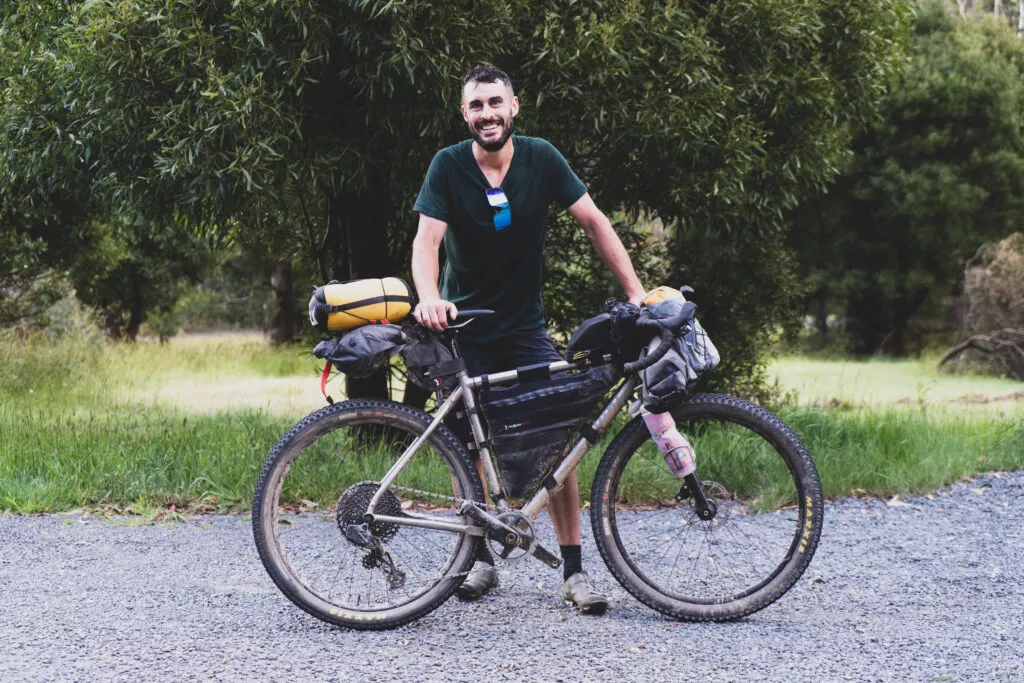
- MTB or gravel bike.
- Aside from a few technical sections, most gravel is more than suitable for a gravel bike.
Supplies?
- You shouldn’t have too much trouble finding something to eat, there are towns that litter the map at mostly short intervals.
- Water can become difficult when the weather becomes hot. Safe water sources can be hard to find between towns.
Why detour to Hobart instead of going to Dover?
- Personally, we heard that the track is quite beaten up between New Norfolk and Dover and that it’s not great riding.
- We were to arrive in Hobart to celebrate New Years Eve so for us that was a better option.
- Getting back to Hobart seemed tricky, I believe you can catch a bus but that sounds like hard work.
Section 1 →41km ↑600m ↓332m ⇢39%
Devonport to Sheffield
The first part of The Tasmanian Trail is likely the most relaxing with a gentle roll down The Mersey River into the town of Latrobe.
From Latrobe there is the option to follow the original Tasmanian Trail Route or cycle over the recently completed, longest, single-span, pedestrian suspension bridge in Australia (The Warrawee Bridge) which leads to a MTB Trail that winds it’s way into Railton. (We haven’t ridden it yet so we can’t speak of the condition).
After a coffee in Railton, there’s some alternating sections of smooth and slightly more technical gravel before the scenic Mount Roland comes into view before Sheffield.
“We didn’t stay in Sheffield, rather choosing to continue on into Deloraine, however, Sheffield is a vibrant and beautiful town with plenty of accommodation and food options available. ”
Section 2 →57km ↑1,055m ↓1,071m ⇢65%
Sheffield to Deloraine
This sections features a fairly steep gravel climb early on before a detour that will take you off the original Tasmanian Trail route and down some forestry roads avoiding what can be at times a rather tricky crossing of The Mersey River. This route takes you over a bridge (rather than crossing by foot) which provides an opportunity to top up your bottles (always treat your water in Tasmania) or take a quick dip in The Mersey River should the weather be warm.
There’s lovely views of the Great Western Tiers mountain range coming into Deloraine although the original Tasmanian Trail & this route will take you past without stopping in. So if you plan on staying in Deloraine, make sure you take a left at Highland Lakes Rd and follow it into town.
“We found a lovely AirBNB to stay in whilst in Deloraine and enjoyed the convenience of Woolworths supermarket and there being plenty to eat. Deloraine is a great place to stop and recharge on the trail.”
View Map on RWGPS
Section 3 →71km ↑983m ↓940m ⇢24%
Deloraine to Poatina
Sadly, we spent this day exploring all the places that you probably shouldn’t take your bike when doing the Tasmanian Trail. Which is great for this write-up because we now know exactly why you shouldn’t go there.
To be fair, as you’ll see in the photos below, there are some beautiful places in Cluen Tiers and the Poatina Bypass, however they are extremely difficult to navigate and you’ll end up carrying your bike for long periods of time, up cliff-faces and over or around trees. It appears that the Cluen Tiers route has been blocked by those not wanting you to cross near or through their land by the way of felling numerous trees over the now overgrown track. The Poatina bypass seems to have been severely washed out and damaged by repeated landslides and storm events.
Whilst a bit more mundane into Poatina, the beauty of Tasmania is still undeniable and you’ll have a much better (and safer) time.
“We didn’t get to see the township of Poatina, however, there is a general store, a cafe and accommodation options as well as a roadhouse in Bracknell along the way.”
View Map on RWGPS
Section 4 →60km ↑1311m ↓555m ⇢28%
Poatina to Miena
Again, as the Poatina Bypass is no longer viable, today features a little more road than you might enjoy on a gravel bikepacking tour, although while steep, the climb out of Poatina has amazing elevated views and the landscape changes dramatically once you hit the Central Highlands.
On the way up the Poatina Rd climb, you can stop in at the power station for views over the region and once you are closer to the gorgeous, little town of Miena, you’ll start to see views of the incredible Arthur and Great Lakes.
“We were extremely lucky as our friend had a holiday shack in Miena, however the Miena Village would be your best option for accommodation and a warm meal. They also have a wonderful general store that even stocks bike supplies!“
Section 5 →83km ↑837m ↓1805m ⇢89%
Miena to Ouse
It’s hard to play favorites, but this was easily our favorite day on the bike for the whole tour.
With 1000m more spent descending than ascending being one of the main reasons, cycling the gravel roads of The Central Highlands and descending into Ouse were absolutely breathtaking experiences not to mention the section through Bronte Park that features Echo Lake and even a small general store for an early morning snack.
We took a little detour off the Tasmanian Trail into Ouse which we have reflected in the map below as the gravel roads were absolutely perfect to descend on.
“We chose not to stay in Ouse as we struggled to find any accommodation available and decided to carry onto New Norfolk instead.
View Map on RWGPS
Section 6 →74km ↑1620m ↓1685m ⇢60%
Ouse to New Norfolk
Straight out of Ouse (turning onto Lake Repulse Rd) you’ll encounter a sign suggesting that the bridge is closed which is very much the case for cars but not for bikes. You will be able to safely traverse this bridge.
Following this section, a little bit of technical gravel follows and a little creek crossing before hitting some lovely forestry roads outside of Ellendale. (Ellendale has a little general store but it’s hours are limited to weekdays).
Gravel sections follow into New Norfolk where you will be able to fully resupply anything you need. You can detour via Westerway if you would like to sample a lovely berry farm however the roads are a little bit busy.
“We stayed at the caravan park in New Norfolk which was very comfortable. New Norfolk is a very big town with anything you can think of available.”
View Map on RWGPS
Section 7a →67km ↑1655m ↓1666m ⇢69%
New Norfolk to Geeveston
“From this point onwards on the Tasmania Trail we haven’t scouted unfortunately as we did a lovely alternate route that took us back into Hobart. (Scroll down for this route in Section 7b and 8b).
We do know that there are quite a few long, technical sections – notably along Jeffreys Track.
If you have completed these sections, we would love to hear from you and any photos you might be willing to donate to help others navigate the route safely!”
View Map on RWGPS
Section 7b →76km ↑1192m ↓1224m ⇢40%
New Norfolk to Cygnet
If you have the time, this is a lovely way to see more of Tasmania as this section follows the Huon River by way of a lovely ride through to Cygnet.
There are parts of Jeffreys Track that you will have to negotiate which is a necessary evil to get you through to Huonville.
If you would prefer a more direct route to Hobart, shortcut via Pelverata Rd (an awesome gravel section after Huonville).
“We booked late so we couldn’t find any accomodation in Cygnet, however we did manage to find a place to stay about 10 km’s down the road, on the Huon River where you could walk down and shuck fresh oysters right off the jetty!
View Map on RWGPS
Section 8a →33km ↑803m ↓825m ⇢83%
Geeveston to Dover
“Again, unfortunately we have not scouted this section. Any information or photos that we can post to help other navigate the route safely would be much appreciated.”
Section 8b →71km ↑1516m ↓1511m ⇢17%
Cygnet to Hobart
While we would have liked to include more gravel adventuring, unfortunately it’s slim pickings out this way until you get a bit closer into Hobart where you’ll find some short sections of non-technical gravel.
This route intensionally detours close to the ferry from Kettering to Bruny Island should you like to stop over and do a lap (this won’t be done in a day).
From there the route takes in the sights of the pub in Longley, The Cascade Brewery, the base of Mt Wellington (Kunanyi) and of course the views into Hobart.
“We couldn’t help but stop in at Longley for a cool brew and then again at the Cascade Brewery for another.”


